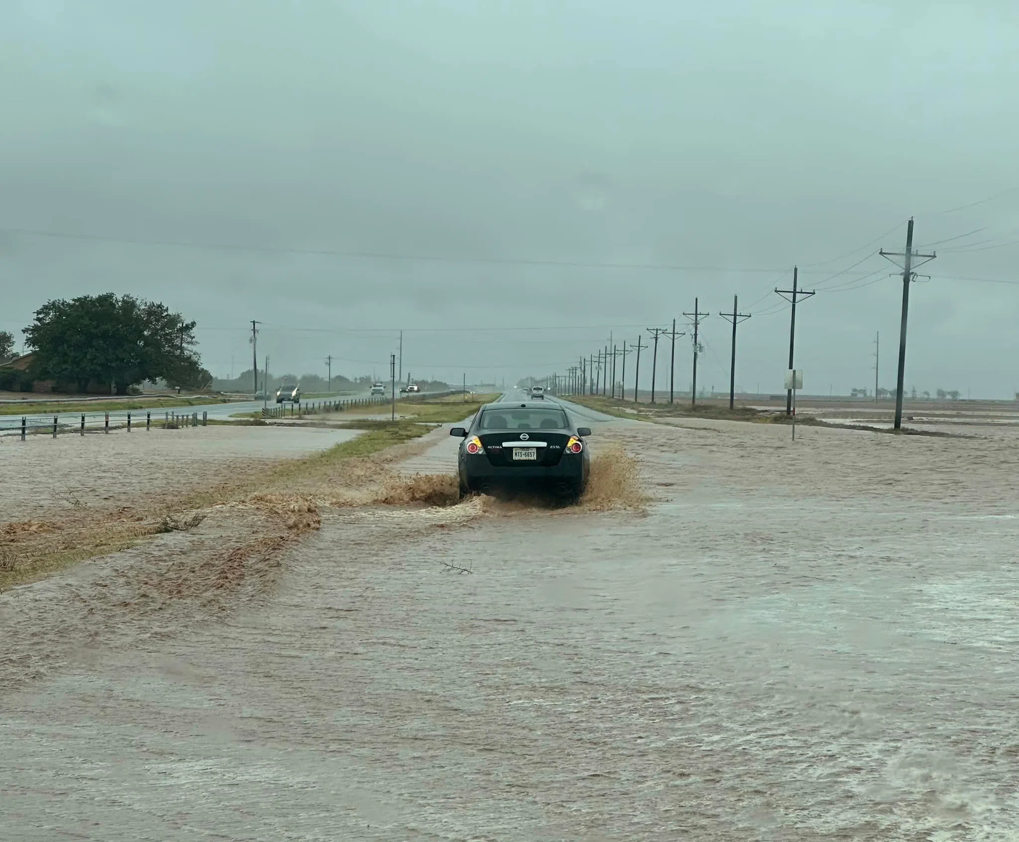
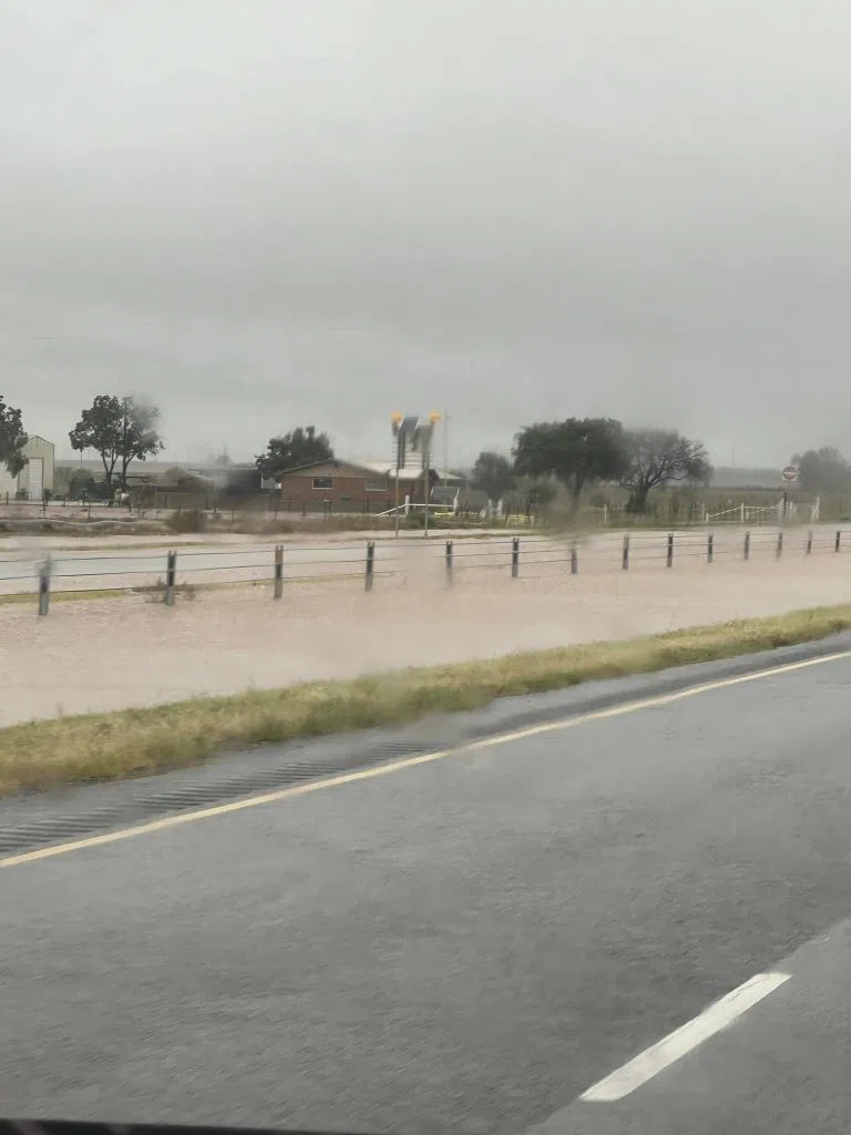
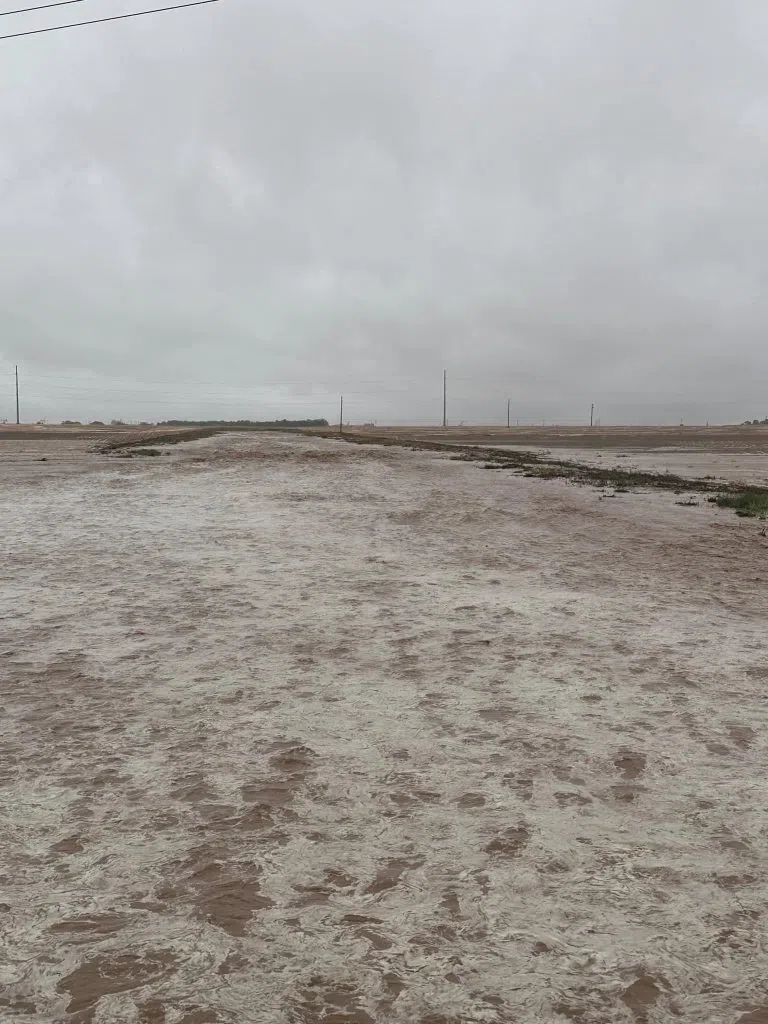
FLASH FLOOD WARNING: These photos are just north of Big Spring and include N Hwy 87, FM 846, and FM 669. There are areas of pathways that are impassable due to water lines and debris that have washed into roadways. ***TURN AROUND, DON’T DROWN***
(courtesy photos)

Weather Notice
Notice Title: Flash Flood Warning issued September 3 at 11:45AM until September 3 at 3:00PM by NWS Midland/Odessa TX – Howard County
Alert: FFWMAF The National Weather Service in Midland/Odessa has issued a *Flash Flood Warning for:
—Southeastern Borden County
—Northeastern Howard County
—Northwestern Mitchell County
—Southwestern Scurry County
* Until 3:00 PM CDT. *
At 11:45 AM CDT, Doppler radar indicated thunderstorms producing heavy rain across the warned area. Between 0.5 and 1.5 inches of rain have fallen. Additional rainfall amounts of 0.5 to 1 inch are possible in the warned area.
Flash flooding is ongoing or expected to begin shortly.
HAZARD…Flash flooding caused by thunderstorms.
SOURCE…Radar.
IMPACT…Flash flooding of small creeks and streams, urban areas, highways, streets and underpasses as well as other poor drainage and low-lying areas.
* Some locations that will experience flash flooding include… Big Spring, J B Thomas Reservoir, Vincent and Cuthbert.
Instructions: Turn around, don’t drown when encountering flooded roads. Most flood deaths occur in vehicles. Be aware of your surroundings and do not drive on flooded roads.
Target Area: Borden, TX; Howard, TX; Mitchell, TX; Scurry, TX


Comments