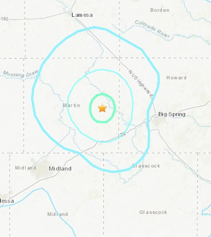
MARTIN COUNTY, TX — Monday evening, an earthquake recorded at 7:55 PM 18 km (approximately 11 miles), north of Stanton was documented with a 4.3 magnitude by the U.S. Geological Survey (USGS).
This morning, the USGS updated their information to report that the earthquake was actually measured as a 4.5 magnitude, and was recorded to be 7.8 km, or 4.8 miles deep. The original depth of the earthquake recorded yesterday was listed as approximately 1.75 miles.
The U.S. Geological Survey, or USGS, is a scientific agency of the United States government that studies the landscape of the United States, its natural resources, and the natural hazards that threaten it.
Locally, KBest News had reports of people feeling the earthquake throughout Howard County, and even as far away as Midland, Lamesa, and Colorado City.

Photo: U.S. Geological Survey, 12/28/21


Comments